Category:Hornby, Hambleton
Jump to navigation
Jump to search
village and civil parish in Hambleton, North Yorkshire, UK  | |||||
| Upload media | |||||
| Instance of | |||||
|---|---|---|---|---|---|
| Location | Hambleton, North Yorkshire, Yorkshire and the Humber, England | ||||
| Population |
| ||||
| Area |
| ||||
 | |||||
English: Hornby is a village and civil parish in the Hambleton district of North Yorkshire, England. It lies on a minor road between Great Smeaton and Appleton Wiske.
Media in category "Hornby, Hambleton"
The following 67 files are in this category, out of 67 total.
-
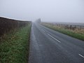
 Approaching Hornby - geograph.org.uk - 3238045.jpg 640 × 480; 54 KB
-
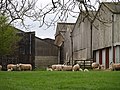 Barns and sheep at Hornby Green Farm. - geograph.org.uk - 394498.jpg 640 × 480; 125 KB
-
 Bedale Hunt on Hornby Green 1960s - geograph.org.uk - 4183529.jpg 640 × 428; 101 KB
-
 Bonfire night 1965 - geograph.org.uk - 4184646.jpg 1,024 × 686; 78 KB
-
 Bridleway along field edge - geograph.org.uk - 6080719.jpg 4,320 × 3,240; 2.01 MB
-

-
 Cattle grid at Outgate Corner - geograph.org.uk - 4970581.jpg 640 × 480; 125 KB
-
 "Cheesecake" hill - geograph.org.uk - 193971.jpg 640 × 480; 46 KB
-
 Cheesecake Bank - geograph.org.uk - 3147996.jpg 3,648 × 2,736; 2.06 MB
-
 Cheesecake Bank towards Hornby - geograph.org.uk - 3238022.jpg 640 × 480; 44 KB
-
 Church Garth in Great Smeaton - geograph.org.uk - 3148425.jpg 3,648 × 2,736; 1.96 MB
-
 Cottage in Hornby - geograph.org.uk - 3148409.jpg 3,648 × 2,736; 2.85 MB
-
 Cottage, Hornby - geograph.org.uk - 3238048.jpg 1,600 × 1,070; 286 KB
-
 Dales Farm - geograph.org.uk - 1352039.jpg 640 × 480; 79 KB
-
 Did the Romans march straight on^ - geograph.org.uk - 6080746.jpg 4,320 × 3,240; 2.21 MB
-
 Ditch near Great Smeaton - geograph.org.uk - 4970563.jpg 640 × 480; 140 KB
-
 Entering Great Smeaton - geograph.org.uk - 3237288.jpg 640 × 480; 52 KB
-
 Farm track, Gt Smeaton - geograph.org.uk - 6079718.jpg 4,320 × 2,645; 1.97 MB
-
 Farmland near Dales Farm - geograph.org.uk - 3238057.jpg 640 × 480; 55 KB
-
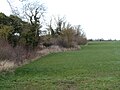
 Farmland near Great Smeaton - geograph.org.uk - 3237282.jpg 640 × 480; 58 KB
-
 Farmland west of Hornby - geograph.org.uk - 3238050.jpg 640 × 480; 53 KB
-
 Farmland, Cheesecake Bank - geograph.org.uk - 3238015.jpg 640 × 480; 61 KB
-
 Field entrance near Staindale Grange - geograph.org.uk - 3238072.jpg 640 × 480; 81 KB
-
 Field entrance off Cheesecake Bank - geograph.org.uk - 3238010.jpg 640 × 480; 74 KB
-
 Field entrance off the A167 - geograph.org.uk - 3237290.jpg 640 × 427; 38 KB
-
 Field entrance, Hornby - geograph.org.uk - 3238042.jpg 640 × 480; 55 KB
-
 Footpath Alongside Far End Farm - geograph.org.uk - 199043.jpg 640 × 384; 112 KB
-
 Gated farm track, Outgate Corner - geograph.org.uk - 3238027.jpg 640 × 480; 46 KB
-
 Grange Arms, Hornby - geograph.org.uk - 2431742.jpg 640 × 481; 61 KB
-
 Halfway Cottage - geograph.org.uk - 3148417.jpg 3,648 × 2,736; 2.49 MB
-
 Hedgerow near East Sockburn Farm - geograph.org.uk - 1352021.jpg 640 × 480; 81 KB
-
 Hornby - geograph.org.uk - 4970575.jpg 640 × 480; 140 KB
-
 Hornby Grange - geograph.org.uk - 350500.jpg 640 × 480; 111 KB
-
 Hornby Green Farm - geograph.org.uk - 3620648.jpg 640 × 480; 108 KB
-
 Hornby Green Farm - geograph.org.uk - 376634.jpg 640 × 480; 100 KB
-
 Hornby village green - geograph.org.uk - 6080726.jpg 4,320 × 3,240; 4.28 MB
-
 Kirkly Wiske, c.1908.jpg 2,484 × 1,713; 901 KB
-
 Lane heading north - geograph.org.uk - 3238063.jpg 640 × 480; 45 KB
-
 Lane heading north - geograph.org.uk - 3238073.jpg 640 × 480; 40 KB
-
 Lane heading north - geograph.org.uk - 3238445.jpg 640 × 480; 75 KB
-
 Londglands and Cross Hill Hall Farms - geograph.org.uk - 598461.jpg 640 × 426; 40 KB
-
 Longlands Farm - geograph.org.uk - 3238037.jpg 640 × 480; 41 KB
-
 Minor road towards Great Smeaton - geograph.org.uk - 3238053.jpg 640 × 480; 55 KB
-
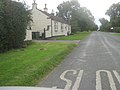
 Minor road towards Hornby - geograph.org.uk - 3237285.jpg 640 × 480; 35 KB
-
 Oilseed rape near Great Smeaton - geograph.org.uk - 2430456.jpg 640 × 482; 86 KB
-
 Outgate Corner - geograph.org.uk - 3148400.jpg 2,918 × 2,189; 1.26 MB
-
 Outgate Corner - geograph.org.uk - 3238036.jpg 640 × 480; 39 KB
-
 Postbox, Hornby - geograph.org.uk - 2431902.jpg 480 × 640; 65 KB
-
 Road junction B1264 and Dinsdale road - geograph.org.uk - 598451.jpg 640 × 426; 31 KB
-

-
 Sign for the Grange Arms - geograph.org.uk - 2431896.jpg 640 × 480; 83 KB
-
 The back of Hornby Methodist Chapel - geograph.org.uk - 428290.jpg 640 × 426; 91 KB
-
 The Grange Arms - geograph.org.uk - 6080723.jpg 4,061 × 2,363; 1.53 MB
-
 The Old School House in Great Smeaton - geograph.org.uk - 3148433.jpg 3,648 × 2,736; 2.52 MB
-
 The village pump.jpg 640 × 480; 177 KB
-
 Track to Carthagena Farm - geograph.org.uk - 6080736.jpg 4,320 × 3,240; 2.02 MB
-
 Track to East Sockburn Farm - geograph.org.uk - 3238438.jpg 640 × 480; 59 KB
-
 Village green, Hornby - geograph.org.uk - 1352037.jpg 640 × 480; 106 KB
-
 Village pump, Hornby - geograph.org.uk - 2431730.jpg 480 × 640; 72 KB
-
 Village scene, Hornby - geograph.org.uk - 2430466.jpg 640 × 481; 86 KB
-

-
 West Lane - geograph.org.uk - 6232605.jpg 640 × 360; 117 KB
-
 Wiske Farm, Hornby - geograph.org.uk - 350503.jpg 640 × 480; 89 KB
-
 Wiske Farm, Hornby. - geograph.org.uk - 291057.jpg 640 × 480; 62 KB
-
 Woodland, Staindale - geograph.org.uk - 3238441.jpg 640 × 480; 90 KB
-
 B1264 at Staindale Bridge - geograph.org.uk - 114374.jpg 640 × 480; 69 KB
-
 Grange Arms , Hornby. - geograph.org.uk - 162818.jpg 640 × 374; 72 KB


